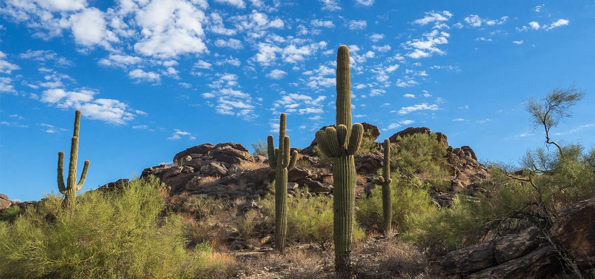
A tough cardio incline, saguaros, a rock tunnel and lots of places to play? This is my favorite hike.
It’s a phrase that’s become a common joke with my hiking friends. Midway through almost any scenic trail, recency bias inspires us to proclaim it’s the best we’ve ever trekked.
So one day years back on South Mountain’s Mormon Trail to Hidden Valley Loop, it was designated “favorite.” And since I’ve hiked it each year since, I’m starting to think it might actually be one of the best in town.

South Mountain Park & Preserve is a hiking wonderland in itself. Just 20 minutes from the core of the city, this massive 16,000-acre slice of the Sonoran Desert offers crisscrossing trails for all hiking levels. You can climb up to the highest accessible point at Dobbins Lookout, or wander the 12-mile National Trail from its East to West ends.
And if you want to have some fun clambering over, through and under lots of rocks, Hidden Valley is your pick.
Hidden Valley via Mormon Trail

Length: 3.4-mile lollipop loop
Duration: 2 hours
Season: Spring is the best for scenery – the trail will be filled with yellow brittlebush and other wildflowers. Winter is great for cool temperatures, and mornings in the late summer/fall are also approachable if you finish before the midday sun. The trail is completely exposed except for the short tunnel.
Crowds: It’s South Mountain’s most popular trail, so expect some steady traffic.
Difficulty: Moderate. The initial climb is steep, and there are sections on the loop that require some rock navigation and careful footing. The trail is hard to follow at points, so know your route and keep an eye out for other hikers.
Dogs: Yes, on a leash – and if they have some clearance to clamber over a few rocks.
Mormon Trailhead to National Trail
The hike begins at Mormon Trailhead, a small parking lot on 24th St. It will likely be full, unless you are there for the sunrise; overflow parking stretches on both sides of northbound 24th.
You’ll get your heart pumping right away on a 1.1-mile ascent up the wholesomely-named Neighborhood Canyon. The views look over the surrounding homes out toward downtown, and the higher you climb, the better they get. You can spot Camelback Mountain, Piestewa Peak and the Papago Buttes in the distance; Four Peaks is also visible out to the east. There are a few spots to take a break and a photo opp on the canyon rocks.


When you reach the junction of Mormon Trail and Mormon Loop, you are presented with three options: A vantage point you can climb for a great view looking north, a trail for Mormon Loop to the left, and a straight southward trail to continue on Mormon Trail. Do not take the loop trail (but climb the hill and back if you want)! Your route should take you straight south, on a sandy path that’s blissfully level after the climb. Here, you’ll reach a sign that indicates a turn off for National Trail.
National Trail Connector
You’ve finished the lollipop stick, and have the choice of which way you want to go around.
Going right: This is the preferred way if you are unfamiliar with the trail, or want an easier descent down rocks instead of a climb up. Head right on the National Trail for .4 miles, and you will see a sign for Hidden Valley/Fat Man’s Pass to the left.
Going left: This is my personal preference because I like the challenge, and am familiar with where the trail leads. I love the gradual approach to higher views and clambering up instead of down. If you decide to go right, you will take a .2-mile jaunt on the National Trail before reaching a turnoff for the Natural Tunnel.
Fat Man’s Pass
To enter Hidden Valley, a challenge awaits: Squeezing through the rock crevice known as Fat Man’s Pass. It’s not a requirement for proceeding; you can hike around to the left if you want. Otherwise, kick your claustrophobia, take off your pack and slip sideways through the rock.

Oh, there is another way over. You can slide on your butt down a sloping rock, slicked with wear from other intrepid hiker butts. My inner child requires I try this at least once every time. Trust me and be cautious if you’re in shorts that might ride up and give you rock burn. Which is definitely not what’s happening in this video…
Hidden Valley
Tucked away from the bustle of bikers and hikers on National Trail, Hidden Valley is aptly named. The .5-mile section of the trail winds through saguaro sentinels, sandy flats and lots of intriguing rock formations. Slow down to play, if it’s in your schedule. You can hop in and around several different pathways and small outcroppings.


Natural Tunnel
The end of your Hidden Valley journey is a 40-foot rock tunnel. Have fun investigating the formations on the sides, and for the adventurous spirits, climbing up on top of the tunnel to explore the rocks above.


If you came from the right, you will have a .2-mile connector on the National Trail back to Mormon Trail, the lollipop stick. Enjoy the views on the way back down to the trailhead.

Preview the Trail with Google Trekker
In 2017, I had the opportunity to be part of capturing the Mormon Trail to Hidden Valley Loop with Google Trekker. This 360° camera technology is the off-road version of Google Street View. To literally put this trail on the map, my team at Visit Phoenix took turns shrugging on the giant, 45-pound camera backpack and walking steadily down the trail. Awkward? Yes. Painfully heavy at times? Oh yeah.
But we did this for you, curious hiker! Check it out, and if you see a gap in the footage, it’s where we had to turn it off to painstakingly slide it down to each other over sloping rocks. Good times.
Click through the hike below or open in a new tab here.
Start of the trail:
Inside the natural tunnel. And yes, that is me, captured for all online posterity as a creeper on the rocks. This way, Hobbitses!